

Cush [Binnia] [Cois]
Good walks are even better shared.
Overview
Cush [Binnia] [Cois]
Welcome to the majestic Cush, one of the hidden gems nestled in the stunning landscape of Donegal, Ireland. At an impressive elevation of 727 meters, this Marilyn offers not only a challenge to hikers but also a feast for the eyes with its dramatic views and unique geological features. Let's take a closer look at what awaits you on your adventure to the top.
Geology
Cush's terrain is shaped by volcanic activity that dates back to the Tertiary period, predominantly showcasing solid basalt formations. This gives the mountain a striking appearance and adds a layer of intrigue to your hike. Remember, this isn’t a mountain you can just walk over; it has character!
Routes
The most popular route is the Binnia Loop Trail, starting from a convenient parking point at R894262. This moderately challenging 6 km route will lead you through heather-covered hills and reward you with stunning panoramic vistas. Allow about 2.5 hours to complete the loop, and don’t forget to stop and catch your breath while soaking in the scenery!
Summit Features
Reaching the summit will greet you with a robust trig point, standing as a proud mark of your accomplishment. Adventurers often leave behind small tokens at the base of the trig, a tradition that adds a personal touch to your summit experience. Take time to reflect at this point high above the world - just don’t forget to document it on social media!
Terrain Type
Expect a mixed bag of terrain. While sections are delightfully grassy, others can be rocky or boggy, especially after a rain shower. Good hiking boots are a must unless you want to audition for a slip-and-slide competition.
Views
The views from Cush are nothing short of spectacular. On a clear day, be prepared to gaze upon Lough Foyle, the sweeping Donegal hills, and even catch a glimpse of the Isle of Donegal. For the best visibility, spring and early autumn are recommended; let’s face it, no one enjoys a hike shrouded in mist!
Hazards
While Cush is generally welcoming, don’t let your guard down. Sudden weather changes can turn your hike into an unexpected adventure. Slippery paths and the potential for spotting ticks in vegetation are realities hikers should prepare for. Pack accordingly!
Nearby Summits
Cush is not alone in its grandeur. Nearby summits such as Binnian Beg (700 m) and Carrick (Binnian) (750 m) beckon explorers looking for more challenges after conquering Cush.
Access
Parking is available at R894262, but spaces are limited—an early start is recommended! Public transport options are sparse, so driving is your best bet. Limavady, just a stone's throw away, offers amenities to prepare before you head out.
Facilities
At the trailhead, facilities are non-existent; however, make your way to Limavady for cafes and shops to gather provisions for your journey.
History
The etymology of Cush harks back to the Irish word cuis, suggesting a historical significance as an abode, resonating with ancient roots in this land. You’ll find scattered archaeological sites around, a whisper of those who tread before us.
In conclusion, Cush [Binnia] [Cois] is more than just a mountain; it’s a gateway to discovering the rich landscapes and history of Donegal. So lace up your boots, pack your snacks, and embark on this captivating journey! Happy hiking!
Explore routes near Cush [Binnia] [Cois]
Public walks starting within 80 km of this hill. Nearby does not mean a route reaches the summit; check its map and access before setting out.
No public routes are currently listed within 80 km of Cush [Binnia] [Cois] on Walkmates. This does not mean there are no paths here. Explore the map and check local access information before planning a walk.
Route planning notes
These notes describe possible approaches, not verified navigable routes or permission to cross land. Check current paths, local access rules and conditions before setting out.
Binnia Loop Trail
A scenic route starting from the car park at R894262, winding through lush heather and offering panoramic views.
Make a day of it, together
Find someone to share the walk with, or organise a day out along a route you like.
Photo Gallery
View all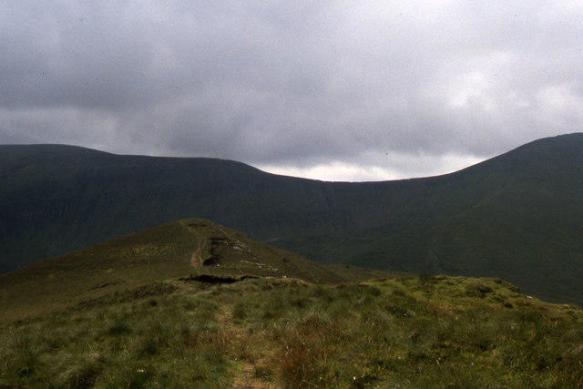 Photo could not load
R8926 : Summit ridge on Cush
Colin Park
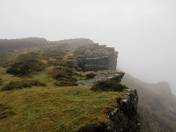 Photo could not load
R8926 : Crags and Hags
kevin higgins
Hill facts and local notes
Classifications
Elevation
641m
2,104 ft
Prominence
176m
Coordinates
52.3877, -8.1559
R894262
OS Map
74
At the Summit
The summit is marked by a substantial trig point, which proudly stands sentinel over the surrounding landscape. Hikers often leave small tokens of appreciation at its base.
Terrain & Geology
Cush features volcanic rock formations from the Tertiary period, primarily composed of basalt. These rugged structures give character to its slopes and provide a stunning backdrop for adventurers.
Views & Scenery
From the summit, hikers can enjoy breathtaking views of Lough Foyle, the Donegal hills, and on a clear day, the Isle of Donegal itself.
History & Heritage
Name Origin
The name Cush may derive from the Irish word 'cuis' meaning 'the abode', reflecting its historical significance as a dwelling place.
Historical Significance
The area around Cush has a rich archaeological heritage, with evidence of ancient settlements scattered throughout the region.
Getting There & Facilities
Check current local access restrictions, parking rules and transport timetables before travelling. These notes do not confirm public access to the summit.
Parking
The nearest parking facility is located at R894262, with space for a limited number of cars. Arriving early is advised during peak seasons.
Public Transport
Public transport options are limited; best to travel by car. The nearest bus service operates from Derry to nearby towns.
Nearby Facilities
There are no facilities directly at the trailhead; however, Limavady offers cafes and amenities for pre-hike preparations.
Safety Information
Known Hazards
- Potential for sudden weather changes, slippery paths after rain, and the presence of wildlife, including ticks.
General Safety Tips
- Check weather conditions before setting out
- Carry appropriate clothing and equipment
- Let someone know your planned route
- Take a map, compass, and GPS device
- Carry emergency supplies: food, water, first aid kit, torch
Hills
Some common questions about the hills answered
Are there group walks up Cush [Binnia] [Cois]?
Many walkers use Walkmates to join or organise walks with others. You can check for group walks around Cush [Binnia] [Cois] through the maps
Are there other walkers around Cush [Binnia] [Cois]?
Activity varies by location and time, but Walkmates lets you see whether others have shared walks or shown interest in this area. Find other people through the walking friends search walking friends for Cush [Binnia] [Cois] search or of course create your own walk for Cush [Binnia] [Cois]
Can I organise a walk to Cush [Binnia] [Cois]?
Yes. If there aren’t any walks listed already, you can create a walk and make it available for others to join.
If you're signed up to Walkmates, you can create a walk to Cush [Binnia] [Cois].
How do I find a walk up this hill?
There are often multiple ways to walk this hill, depending on experience and route preference. Walkmates helps you explore walks and routes that others have shared.
Can I suggest a new route up Cush [Binnia] [Cois]?
Yes. You can suggest or create routes to share with others. Walkmates focuses on the social side of walking, so routes are used to help people organise walks and explore areas together, rather than as detailed navigation tools or route libraries.
Other uses really appreciate knowledgeable walkers sharing their routes. Share your favourite route to Cush [Binnia] [Cois] here
The is an error or something incorrect about this hill. How do I let you know?
We always strive to keep the information on Walkmates as accurate as possible. If you find an error, please let us know through the contact form and we'll aim to correct it as quickly as possible
Community Discussion
Comments
Location
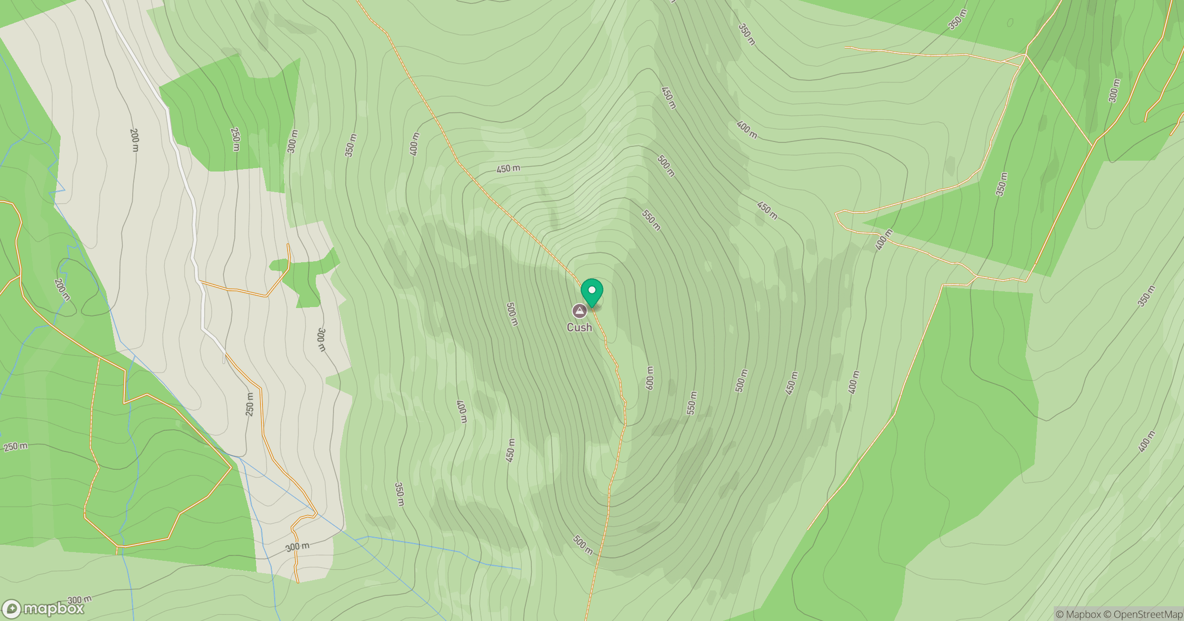
Grid reference: R894262
View on OpenStreetMapOpens a map in a new tab, centred on the hill.
Hills within 30 km
Straight-line distance, not a walking route or confirmation of access.
Galtymore [Cnoc Mor na nGaibhlte]
918m
Greenane
801m
Lyracappul [Ladhar an Chapaill]
825m
Slievenamuck
368m
Temple Hill
784m
No comments yet. Be the first.